10 hr
Tongariro Alpine Crossing Day Hike with Shuttle Transfers
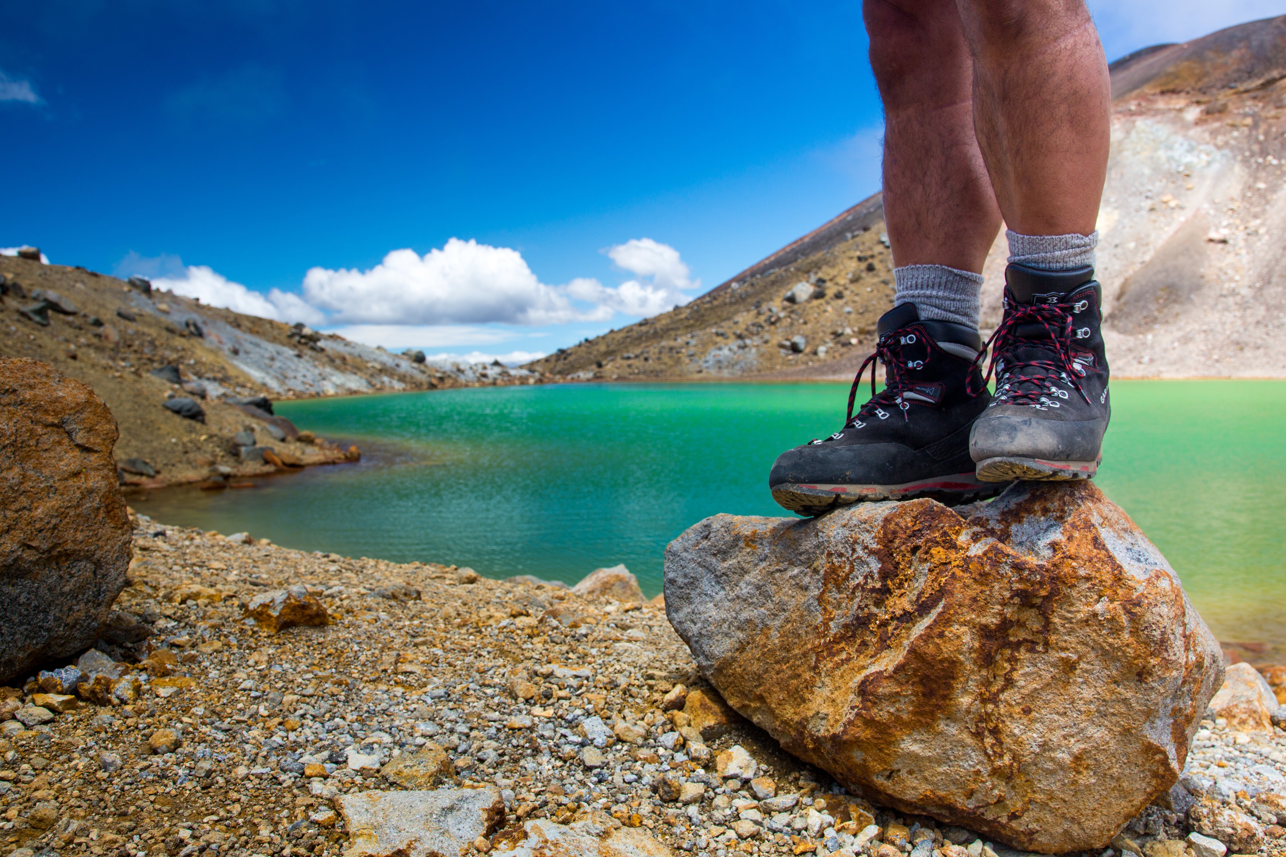
Trek New Zealand's iconic volcanic crossing with easy pickup and drop-off included.
Reserve
Hand-picked by our editors — only the best 5 experiences from 140 reviewed.
Verified partners for every tour, free cancellation where available, and instant confirmation on every booking.
10 hr
Trek New Zealand's iconic volcanic crossing with easy pickup and drop-off included.
Reserve
2 hr 30 min
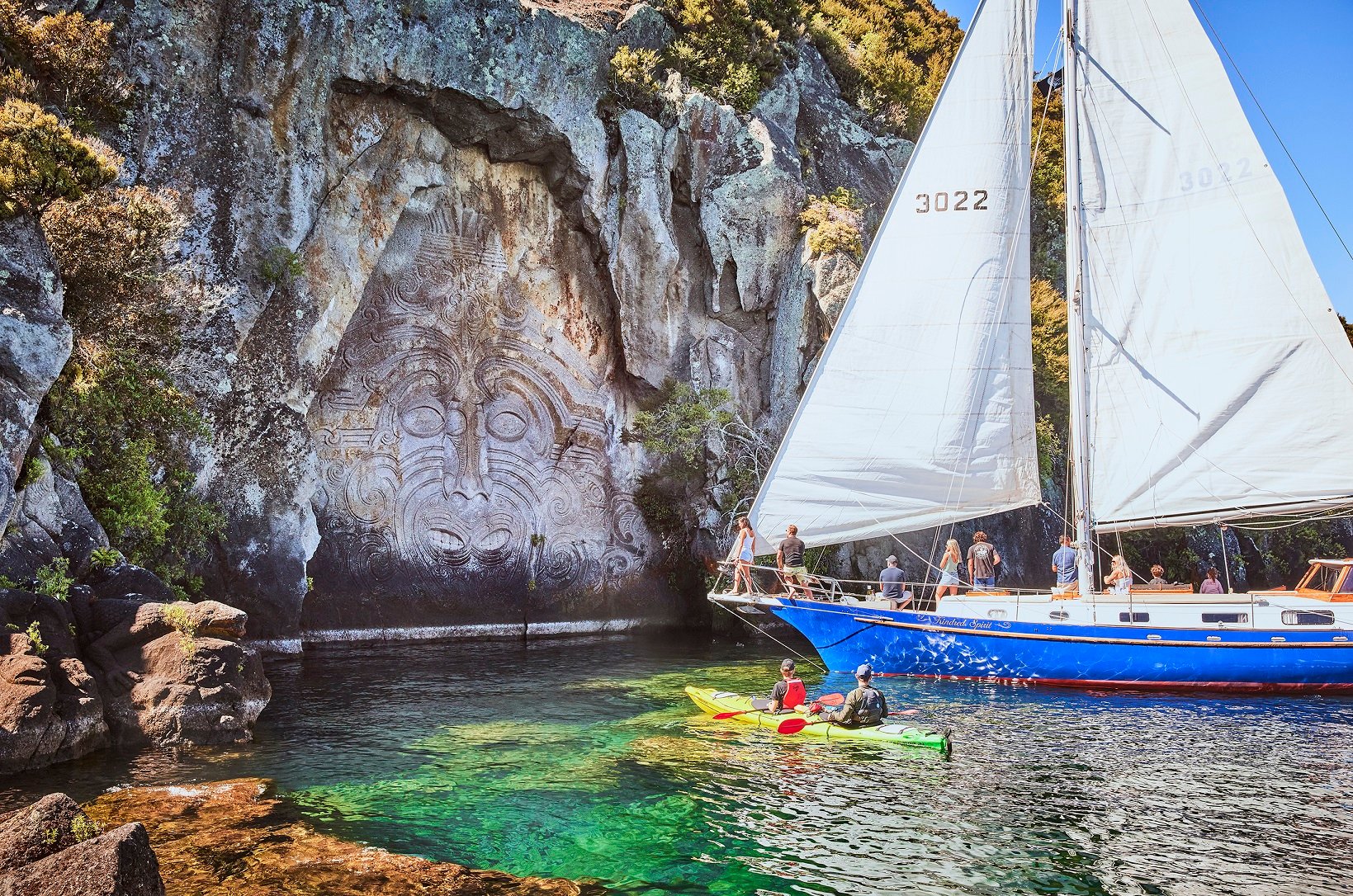
Sail a classic yacht across Lake Taupo to see the towering Māori Rock Carvings up close.
Reserve
30 min
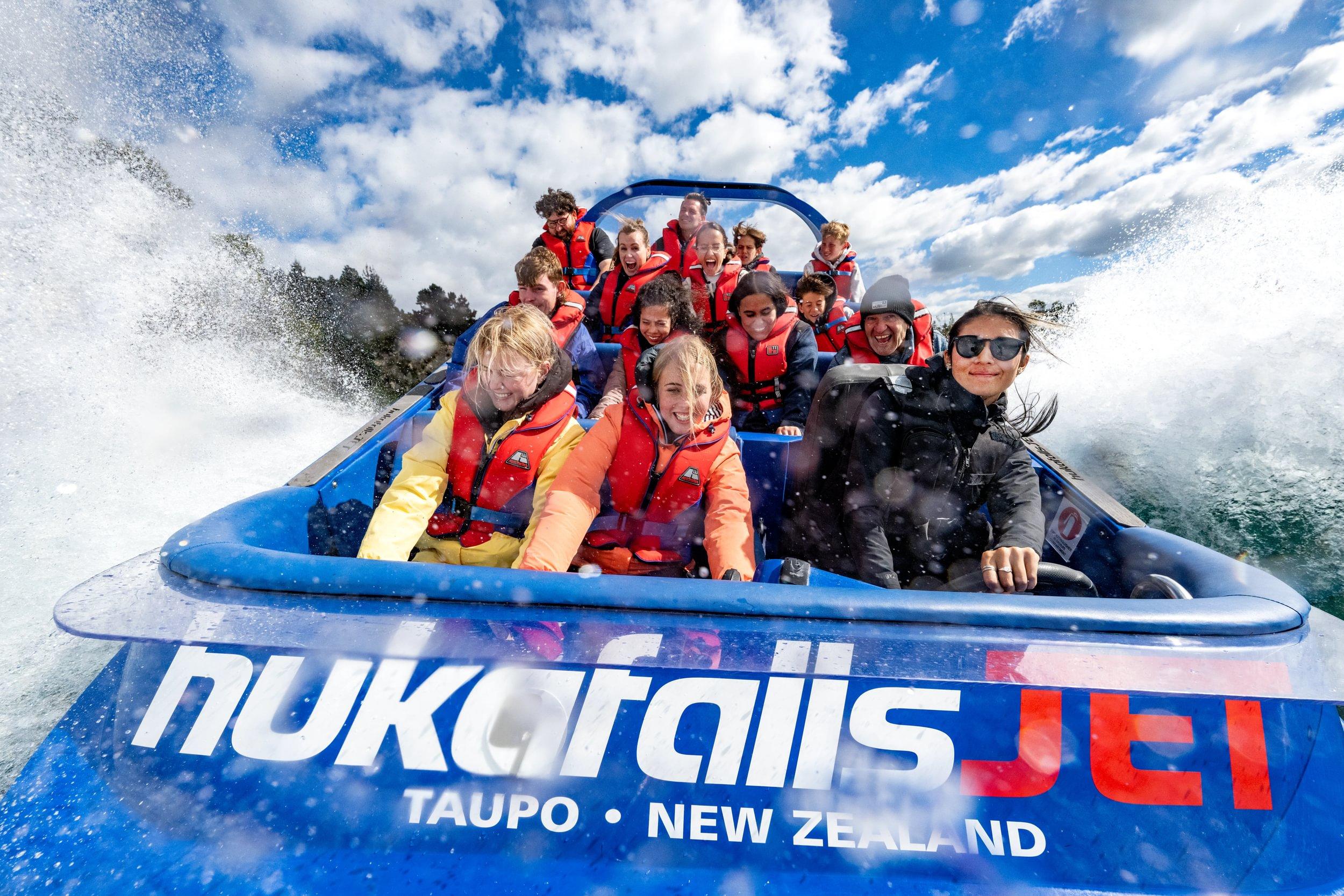
Blast along the Waikato River on a 30-minute jet boat ride to the base of Huka Falls.
ReservePrices from verified partners. Availability updates in real time at checkout. Free cancellation policies apply where shown.
The landmarks, rooms, and views travelers on this tour remember — all visible on a single visit.
Red Crater is the highest point on the Tongariro Alpine Crossing at 1886 m. The exposed rim is one of the most wind-prone sections of the walk and marks the top of the main climb.
The Emerald Lakes, known as Ngā Rotopounamu, sit below Red Crater in a vividly colored volcanic basin. DOC highlights geothermal activity in this area, and the lakes are one of the route’s strongest visual anchors.
Blue Lake, or Te Wai Whakaata o Te Rangihīroa, lies beyond the Emerald Lakes on the descent. It is one of the most culturally significant landmarks on the route and a clear marker that the finish is getting closer.
South Crater is a broad volcanic basin crossed before the ascent to Red Crater. The basin shows how the route moves through multiple crater landscapes rather than a single ridge walk.
Soda Springs is a lower alpine landmark that often signals the transition from valley track to high-country terrain. It is a useful reference point because the more exposed middle section begins soon after.
Ketetahi Road End is the standard finish side for the one-way crossing logistics. DOC notes a private carpark near the end of the hike at Ketetahi, which makes it the natural shuttle retrieval zone.
They complement each other, but most walkers who want the simplest day call the shuttle-based tongariro alpine crossing shuttle from taupo the easier choice. Self-drive and park-and-shuttle works when you want your own car at the end, but it adds more moving parts and more parking friction.
| Feature | Top pick Taupō shuttle | Self-drive + park-and-shuttle |
|---|---|---|
How you get there |
Coach from Taupō to trail | Drive to trail, then shuttle |
| See tickets → |
Verdict: For most Tongariro visitors, the Taupō shuttle is the cleaner logistics choice; self-drive only wins if you specifically want the freedom of your own car before and after the crossing.
Choose your ticket, select your date, and reserve in under two minutes. Secure checkout handled by our verified partner.
Instant confirmation by email, with a mobile voucher you can save offline. No printing, no queuing at a collection desk.
Arrive at the entrance, show your voucher on your phone, and walk in. Most tickets include priority or skip-the-line access.
Practical details for your visit straight from our verified partners — hours, access, rules, and how to get there.
30 Tongariro Street, Taupō
Common shuttle coordination point for Taupō departures
Take the regional shuttle network arranged through the Taupō Customer and Visitor Information Centre, which DOC lists as a shuttle hub for the crossing. The Taupō pickup point is at 30 Tongariro Street.
DOC says shuttle is the best way to get to the Tongariro Alpine Crossing. Summer parking is not available at Mangatepopo for crossing visitors, and DOC does not recommend roadside parking on State Highways.
A taxi or private transfer can be used for point-to-point movement between Taupō and the trail-end logistics point. This is usually used as a backup rather than the main transport option.
Biking is not allowed on the track itself, and DOC lists no mountain biking on the crossing. Use a bike only to reach a shuttle pickup point off-track, if your operator allows it.
Wear warm, layered clothing and carry a waterproof jacket and pants. DOC also recommends a hat, gloves, and sturdy tramping or mountaineering boots for alpine conditions.
Keep your pack small enough to carry food, water, spare layers, and toilet paper. DOC warns that water along the track is not suitable for drinking, so carry enough for the full day and treat the route as a self-sufficient alpine walk.
Photography is allowed, and the route includes major features such as Red Crater, the Emerald Lakes, and Blue Lake. Drones are prohibited without a permit, and DOC generally does not recommend applying for one in this national park.
This is a long alpine crossing with steep, exposed sections and a total elevation change of about +/- 1196 m. DOC describes it as a challenging day walk, so it is not suitable for casual mobility access or prams.
Families should plan for a full-day alpine walk and only take children who are comfortable on long mountain terrain. The route has toilets at several points, but there are no family-style facilities or short enclosed viewing loops on the crossing itself.
Bring all food and enough drinking water for the entire crossing, because water on the track is not suitable for drinking. There are toilets along the route, but no food vendors on the mountain.
The crossing sits in a sacred landscape and DOC asks visitors to respect local iwi and stay on the marked route. Summer parking at Mangatepopo car park is not available for visitors doing the crossing, and DOC does not recommend parking on the side of State Highways.
30 Tongariro Street, Taupō
Common shuttle coordination point for Taupō departures
Get directionsMangatepopo Road end, Tongariro National Park
Track start used for the one-way crossing
Get directionsKetetahi Road end, Tongariro National Park
Common finish point for shuttle retrieval
Get directionsBest time to go, insider tips, nearby landmarks, and the cancellation fine print — flip through to skim what matters to you.
How crowds, weather, and events shift across the year.
Spring can still feel alpine, with changeable weather and lingering snow on higher sections. Crowds are usually lighter than peak summer, but wind and cold can still affect the exposed ridge over Red Crater.
Summer is the busiest season, and DOC says parking at Mangatepopo is not available for crossing visitors. Early starts are useful because shuttle slots and cooler walking conditions are both better in the morning.
Autumn often brings clearer light and more comfortable walking temperatures. The route still requires full alpine preparation because weather can shift fast in the crater basin and near the lakes.
Winter is a specialist season on this track, and DOC says you need special skills and preparation. Snow, ice, avalanche risk, and sub-zero temperatures can turn the crossing into a serious alpine outing.
Small details that turn a good visit into a great one.
DOC’s best arrival window is 06:00–08:00, which aligns with cooler conditions and earlier shuttle options. Early starts also improve your chance of a calmer crossing before afternoon weather builds.
DOC explicitly says water on the track is not suitable for drinking, so bring all you need from the start. There are toilets on the route, but no water refill point that you should rely on.
Red Crater, South Crater, and the Emerald Lakes area can all feel exposed, even in warmer months. Pack waterproof layers, gloves, and a warm hat because conditions can change fast.
DOC says shuttle is the best way to get to the crossing, and a track booking is required for shuttle and guided walk services. Taupō is one of the regional shuttle hubs listed by DOC.
The route crosses mountains sacred to Ngāti Hikairo ki Tongariro of Ngāti Tūwharetoa. Stay on the formed track, do not fly drones without a permit, and avoid summiting restricted areas.
The walk ends far from the start, so confirm your return pickup before leaving Taupō. A one-way shuttle setup is the normal logistics model for the crossing.
Non-bookable sights within a short walk — free to visit, easy to pair.
The highest point on the crossing rises to 1886 m and is one of the most exposed parts of the route. Steam, wind, and loose volcanic rock make it a defining alpine feature.
Ngā Rotopounamu-Emerald Lakes are a set of vivid volcanic lakes below Red Crater. DOC highlights geothermal activity here, and the lakes are a signature photo stop on the route.
Blue Lake, or Te Wai Whakaata o Te Rangihīroa, sits beyond the Emerald Lakes on the descent. DOC notes it is part of the sacred mountain landscape and a major landmark before the final leg.
This alpine spring area appears early in the ascent and gives walkers a clear change from the valley floor to mountain terrain. It is a useful marker before the steeper central section.
South Crater is a broad volcanic basin crossed before the climb to Red Crater. DOC’s avalanche and terrain guidance treats this as part of the serious alpine middle section.
The Ketetahi side is associated with geothermal activity and the finish of the crossing. DOC identifies hot mineral springs and steam vents in this area of Tongariro National Park.
Flexible, no hidden fees.
Track booking is free, and DOC states there is no cost to book the Tongariro Alpine Crossing. If your shuttle operator or guided walk provider has a separate cancellation rule, that policy is set by the operator rather than DOC.
Hand-picked options within walking distance — pick a district for vibe, or a specific hotel for convenience.
A practical base for shuttle departures, with the widest range of motels, apartments, and holiday parks. It is the easiest place to overnight before an early Tongariro Alpine Crossing shuttle from Taupō.
A smaller overnight base closer to the mountain with lodges and backpacker-style stays. Useful if you want to shorten the road transfer before your crossing.
A quieter option south of the track with motels and cabins near Lake Taupō. This can suit visitors linking the crossing with the southern side of Tongariro National Park.
A high-country lodging base within the park area and close to DOC visitor services. Good for travelers who want to combine the crossing with other Tongariro walks.
The 19.4-kilometre track that crosses Tongariro sits inside the fourth national park ever created anywhere on Earth, and the first gifted by an indigenous people. In 1887, Te Heuheu Tukino IV, paramount chief of Ngāti Tūwharetoa, placed the summits of Tongariro, Ngāuruhoe and Ruapehu under Crown protection to keep them whole. Parliament confirmed the arrangement in 1894. UNESCO later inscribed the park twice — for its volcanic geology in 1990, and in 1993 as one of the world's first cultural landscapes, recognising the mountains as ancestors rather than scenery. The route itself is younger than the story around it. Walkers reach it now by road from three directions, and the tongariro alpine crossing shuttle from taupo remains the busiest of them, drawing from the lakeside town roughly 100 kilometres to the north. The track climbs from Mangatepopo Valley across the Devil's Staircase, traverses the flat pumice floor of South Crater, skirts Red Crater at 1,886 metres, and drops past the Emerald Lakes toward Ketetahi. Because it begins and ends at different car parks, a return vehicle is not optional but structural — which is why organised transfers, rather than private cars, carry most walkers each season. The geology is active and unsettled. Red Crater last erupted around 1926. Te Maari, on the northern flank above Ketetahi, erupted twice in 2012, throwing blocks through the roof of a hut and closing the northern section for months. The Emerald Lakes take their colour from dissolved minerals leaching out of neighbouring thermal ground; the water is acidic, and Ngāti Tūwharetoa ask that it not be touched. Ngāuruhoe, the near-perfect cone rising 2,291 metres beside the saddle, is technically a vent of Tongariro rather than a separate mountain. Its side slopes are tapu, and side-trip ascents are discouraged. Demand reshaped the park in the 2010s. Visitor numbers passed 100,000 a year, and the Department of Conservation introduced a free booking system to spread pressure across the day rather than limit it — the track itself carries an entrance fee of 0 NZD, and the crossing stands open every day of the week. Shuttle operators absorbed the rest, staging departures through the small hours so that walkers meet the Devil's Staircase before the afternoon wind rises off the Central Plateau. Bookings for tongariro alpine crossing shuttle from taupo tours now function, in practice, as the park's informal quota system: seats sell out long before the track does, and the road, not the summit, sets the limit.
"The mountains were gifted, not claimed — and the road, not the summit, now sets the limit."
A step-by-step walkthrough of the visit — what you'll see, how long each stage takes, and the details that matter.
You wake in the dark. The tongariro alpine crossing shuttle from taupo collects you between 06:00 and 08:00 — the recommended arrival window, chosen for cooler air and the widest choice of departures — and you watch the lake fall away behind the coach as the road bends south toward the volcanic plateau. At Mangatepopo you step out into cold. You check your booking, tighten your laces, and walk the first flat 40 minutes along the valley floor before the Devil's Staircase begins. You climb roughly 350 metres in an hour. At South Crater the ground flattens into grey pumice and the wind arrives. You cross it in twenty minutes, then push up the loose red scree of the ridge to 1,886 metres, where the crater wall drops away in rust and iron. You stop above the Emerald Lakes. You do not touch the water — it is acidic, and it is sacred. You eat here, sheltered behind a boulder, because there is nowhere better. Then you descend. Blue Lake, the long north-facing traverse, the switchbacks through tussock, and finally beech forest for the last hour into Ketetahi. Your driver is waiting. You sleep most of the way back, and the mountain keeps its shape in the rear window until the road turns.
DOC lists the Tongariro Alpine Crossing as open every day, 00:00–23:59. For visitor planning, the best arrival window is 06:00–08:00 for cooler conditions and earlier shuttle options. Yes. DOC says bookings are recommended for all visitors using any part of the track, and a track booking is required for shuttle and guided walk services. The booking itself is free. DOC states there is no entrance fee and track booking is free, so the Tongariro Alpine Crossing shuttle from Taupō tickets price comes from the transport operator rather than the track. Use the live product grid for the exact shuttle fare and departure time. Wear warm, layered clothing, plus a waterproof jacket and pants. DOC also recommends a hat, gloves, sunscreen, and sturdy tramping or mountaineering boots because the crossing is an alpine walk. Bring your own food and drinking water, because DOC says water along the track is not suitable for drinking. There are toilets on the route, but no food service on the mountain. Small day packs are normal, but drones are prohibited without a permit and dogs are not allowed anywhere in Tongariro National Park. Bikes and 4WDs are also not allowed on the formed track. The route is a demanding alpine crossing, so it is better suited to older children and teens who can handle long climbs, exposure, and changing weather. Families should plan a full-day outing rather than a casual short walk. The main photo landmarks are Red Crater, the Emerald Lakes, and Blue Lake. These are all inside the Tongariro Alpine Crossing route and are the most recognizable volcanic features along the walk. DOC says shuttle services run from all local towns, and Taupō is one of the listed shuttle hubs through the Taupō Customer and Visitor Information Centre at 30 Tongariro Street. That makes the Tongariro Alpine Crossing shuttle from Taupō a standard one-way logistics setup. If the weather turns bad, DOC advises checking conditions and considering alternatives such as the Taranaki Falls Walking Track or the Tama Lakes Track. The crossing has exposed alpine sections, so flexibility is important.
Please contact us for more information.