8 hr
Tongariro Alpine Crossing Roundtrip Shuttle Hike
Hassle-free shuttle to NZ's top-rated day hike, with flexible morning and afternoon transfers.
Reserve
Hand-picked by our editors — only the best 5 shuttle transfers from 40 reviewed.
Verified partners for every tour, free cancellation where available, and instant confirmation on every booking.
8 hr
Hassle-free shuttle to NZ's top-rated day hike, with flexible morning and afternoon transfers.
Reserve
8 hr
Park at Ketetahi, shuttle to the start, hike the Crossing, and finish right back at your car.
Reserve
10 hr
Guided shuttle transfers to New Zealand's iconic 20km volcanic crossing, past craters and emerald lakes.
ReservePrices from verified partners. Availability updates in real time at checkout. Free cancellation policies apply where shown.
The landmarks, rooms, and views travelers on this tour remember — all visible on a single visit.
South Crater is one of the major basins on the route and sits inside a volcanic landscape shaped by past eruptions. DOC’s crossing materials describe the wider track as a 17-kilometre alpine traverse, and this basin is part of the route’s open, exposed middle section.
Red Crater is the highest point on the main crossing and is known for its oxidised rock and strong volcanic character. The climb into this section is one reason DOC classifies the track as difficult and steep.
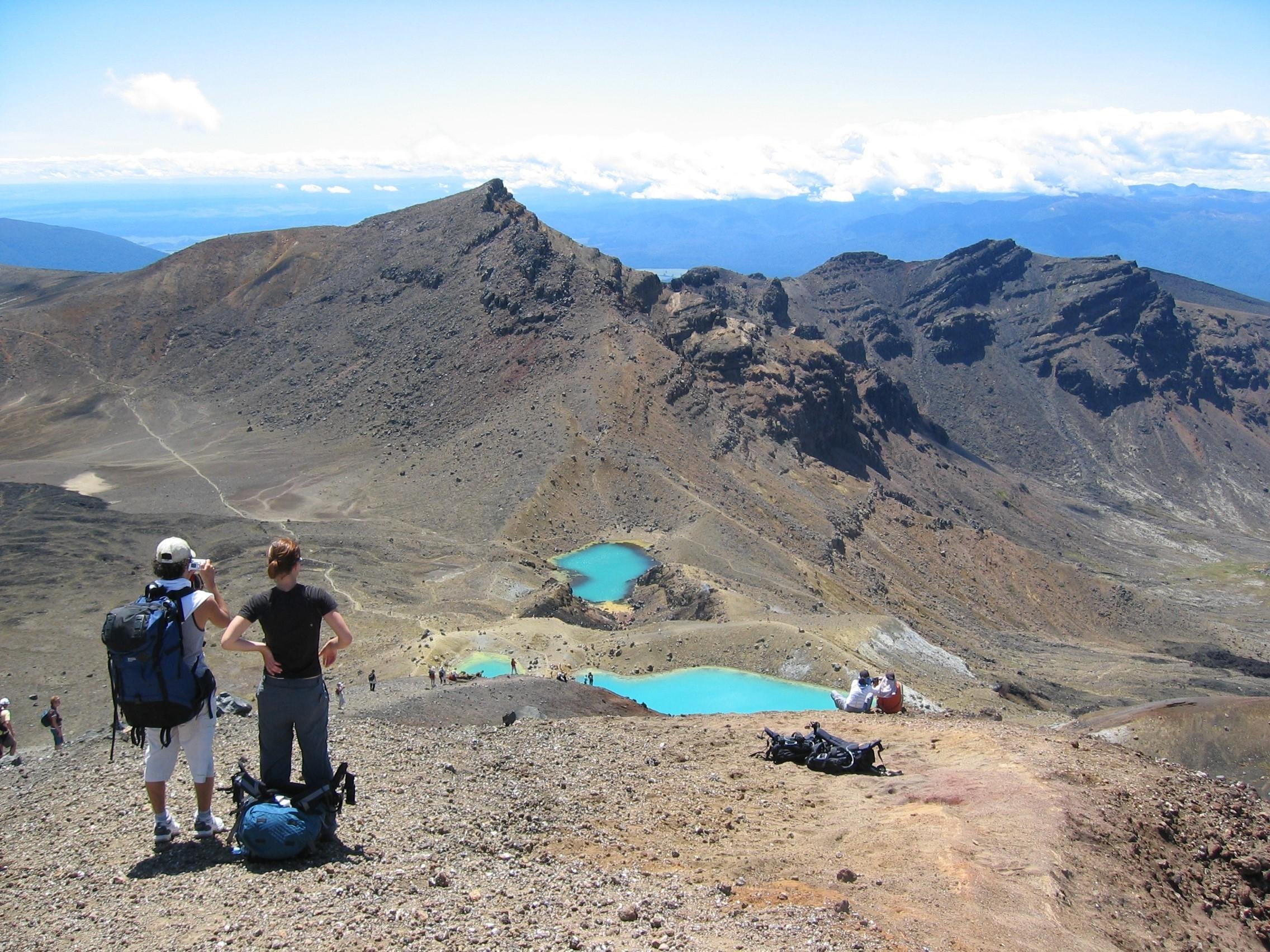
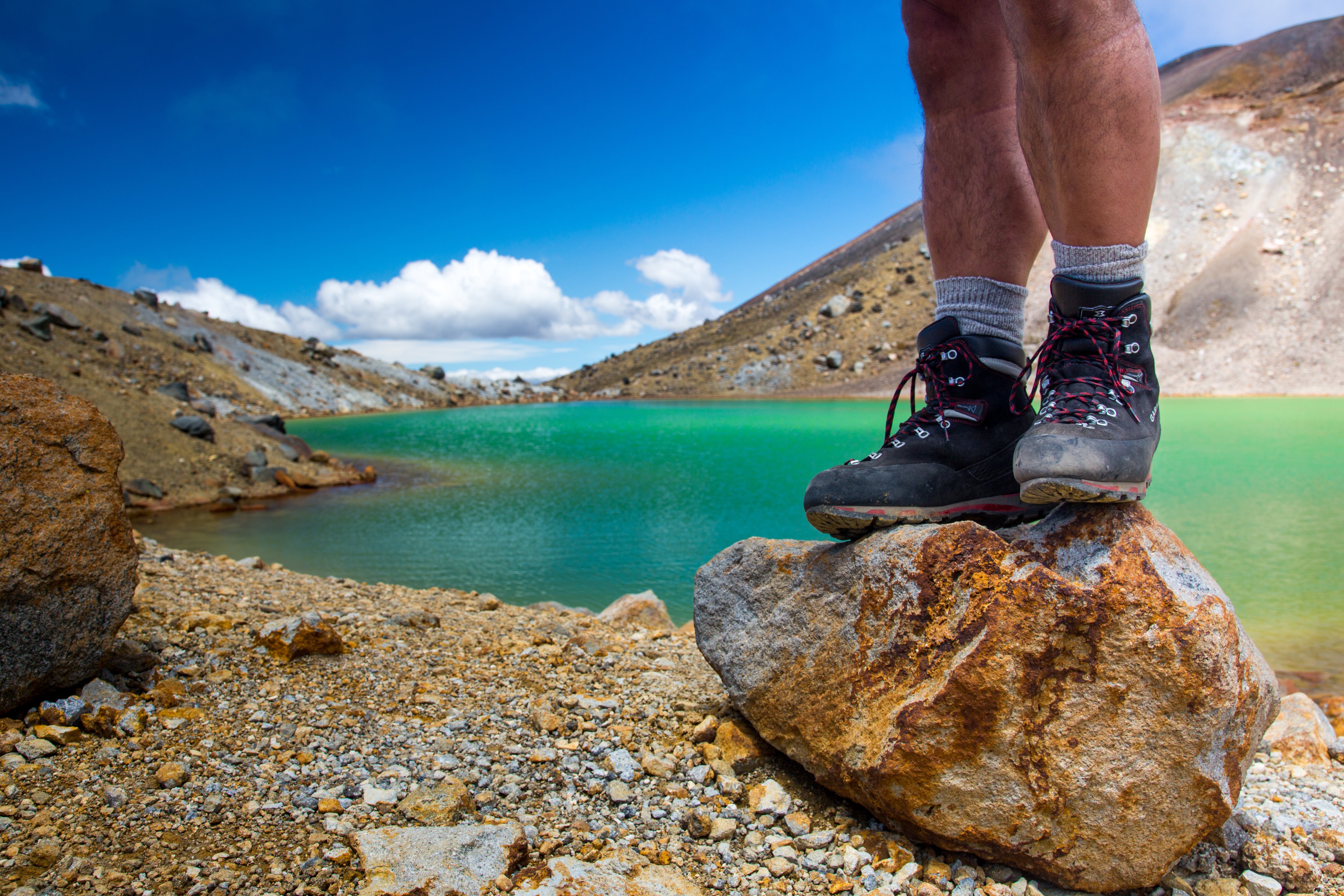
Emerald Lakes are mineral-rich pools that stand out for their bright colour contrast against dark volcanic scree. They are among the most photographed features on the route and sit below Red Crater on the descent.
Blue Lake lies on the route as a sacred alpine water body and provides a calmer visual counterpoint to the harsher crater terrain. DOC notes that the surrounding mountains and waterways carry deep cultural significance for Ngāti Hikairo ki Tongariro of Ngāti Tūwharetoa.
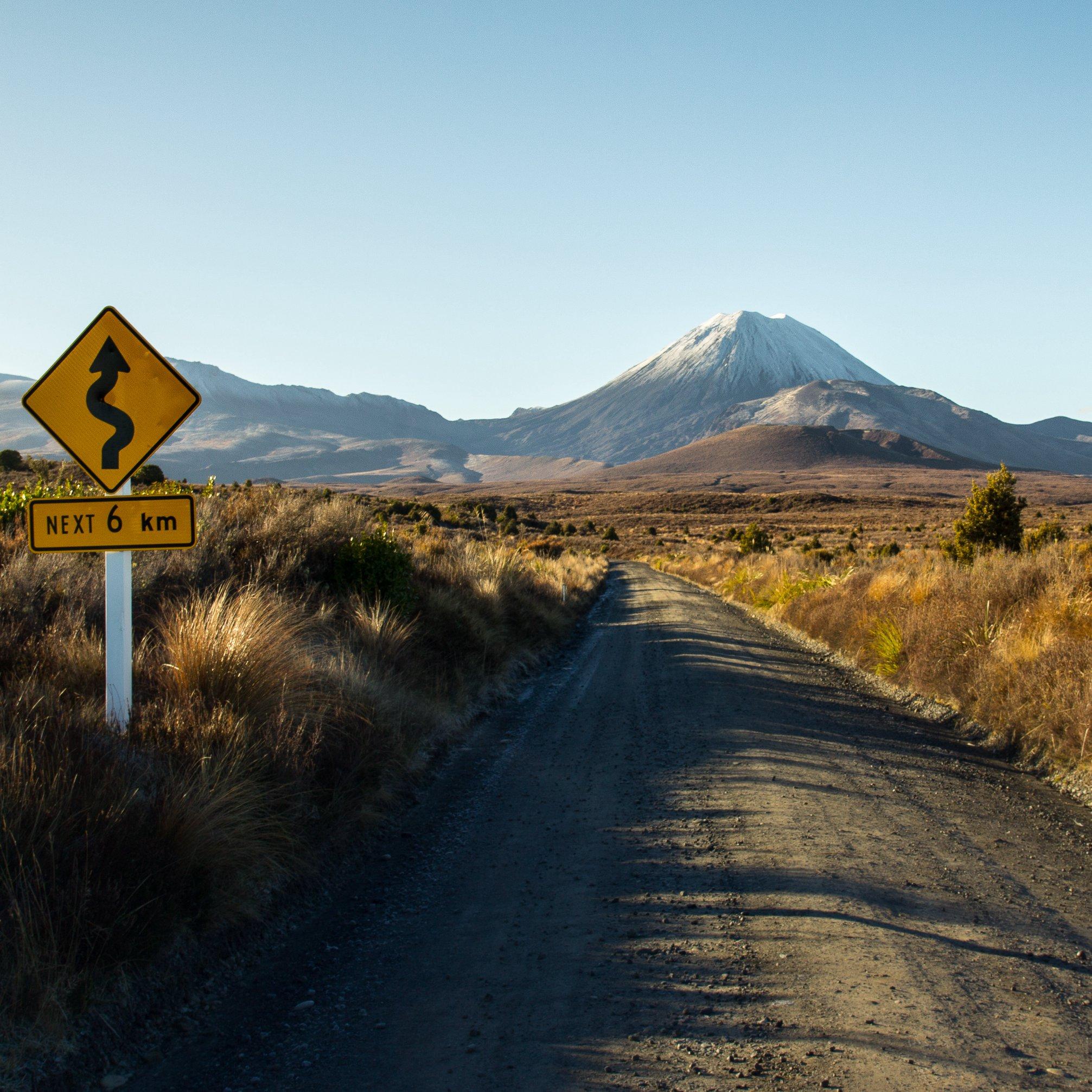
Mangatepōpō Valley forms the starting approach for many walkers and is where track infrastructure and signage are concentrated. The valley’s open terrain makes it a useful orientation point before the steeper climb begins.
The Ketetahi side is the long downhill finish for the one-way route and is where many walkers exit after the crater sections. It is a demanding descent that rewards careful pacing, especially when the track is wet or icy.
They complement each other; the better choice depends on whether you want a trailhead-to-trailhead transfer or an Ohakune-based round-trip shuttle. For most hikers, tongariro alpine crossing shuttle one way is the cleaner fit if you are self-driving and want the classic Mangatepopo-to-Ketetahi finish, while the Ohakune return shuttle suits visitors staying in Southern Ruapehu.
| Feature | Top pick One-way shuttle | Return shuttle from Ohakune |
|---|---|---|
Where you start |
Mangatepopo road end | Ohakune, Raetihi, Horopito |
Where you finish |
Ketetahi road end | Ohakune area pickup point |
Parking needed |
Yes, separate vehicle pickup | Usually no, round-trip transfer |
Best for |
Self-drivers and trailhead swaps | Ohakune-based visitors and day trippers |
Transfer flexibility |
Single start, fixed end logistics | Multiple return times, more flexible |
Typical day length |
7–8 hours hiking plus transfers | All-day outing with shuttle timing |
| See tickets → |
Verdict: Choose the one-way shuttle if you need trailhead logistics solved cleanly; choose the Ohakune return shuttle if you want a simpler same-base transport plan with more return-time flexibility.
Choose your ticket, select your date, and reserve in under two minutes. Secure checkout handled by our verified partner.
Instant confirmation by email, with a mobile voucher you can save offline. No printing, no queuing at a collection desk.
Arrive at the entrance, show your voucher on your phone, and walk in. Most tickets include priority or skip-the-line access.
Practical details for your visit straight from our verified partners — hours, access, rules, and how to get there.
Whakapapa Village, State Highway 48, Mount Ruapehu 3083
DOC information stop for current conditions and maps
Use a shuttle from National Park Village, Tūrangi, Taupō, or Ohakune; DOC says the best way to get to the Tongariro Alpine Crossing is by shuttle.
Drive to a shuttle pickup point or arrange car relocation; summer parking is not available at Mangatepopo car park for crossing visitors.
A taxi can solve last-mile links to shuttle departure points in the park corridor.
Mountain biking is not allowed on the Tongariro Alpine Crossing track itself, so bike access stops outside the route.
Dress for an alpine crossing, not a short day stroll. DOC says conditions can include very cold temperatures, strong wind, heavy rain, poor visibility, and snow at any time of year. In winter, the track can be icy and snow-covered, so layered clothing, waterproof shells, gloves, and sturdy tramping or mountaineering boots are essential.
Expect a normal outdoor transport setup rather than airport-style security. DOC’s visitor information focuses on weather, track conditions, and safety, so keep valuables minimal and pack everything in a daypack you can carry comfortably. For shuttle travel linked to the crossing, do not leave anything important in a vehicle at trailheads, especially if you are using one-way transport.
Photography is allowed on the Tongariro Alpine Crossing, and the route is known for volcanic craters, South Crater, Red Crater, and Emerald Lakes. DOC warns that drones are generally not approved in the national park, so plan on handheld photography instead. The best light for landscape photos is usually around the early-morning arrival window, when congestion is lighter.
The Tongariro Alpine Crossing is a difficult alpine route with steep, exposed, and uneven sections, so it is not an accessible walk for most visitors. DOC does not recommend the track for children under 10. If you need a lower-exposure option, DOC suggests alternatives such as Taranaki Falls Walking Track or Tama Lakes Track when conditions are poor.
DOC says the Tongariro Alpine Crossing is not recommended for children under 10 because it is exposed, alpine, and weather-dependent. Families planning the Tongariro Alpine Crossing shuttle one way should be realistic about fitness, weather, and turnaround time. For younger walkers, DOC’s own guidance points to shorter alternatives in the same national park.
Bring your own water and snacks; DOC says water along the track is not suitable for drinking. The winter gear advice also calls for food and toilet paper. Because this is a one-way shuttle format, pack everything you need before you board and keep it in your daypack.
The best way to reach the Tongariro Alpine Crossing is by shuttle, and DOC says shuttle or guided walk bookings are needed to use the track. In summer there is no parking for visitors at Mangatepopo car park, so one-way transport is the practical choice. DOC also notes a ‘Not Recommended Today’ advisory can be applied in summer hiking season when weather is potentially hazardous.
Whakapapa Village, State Highway 48, Mount Ruapehu 3083
DOC information stop for current conditions and maps
Get directionsBest time to go, insider tips, nearby landmarks, and the cancellation fine print — flip through to skim what matters to you.
How crowds, weather, and events shift across the year.
Summer brings the highest visitor demand and the most active shuttle use. DOC says the route can still see very cold temperatures, strong wind, and poor visibility even in summer, so start early and check the Not Recommended Today advisory.
From May to October, DOC says alpine skills are essential. Shuttle buses generally do not operate during winter; guided trips that include transport are the safer fit.
Spring can still bring snow on higher sections and rapid weather shifts. Expect fewer walkers than peak summer, but keep winter-style layers and traction gear in reserve.
Autumn usually has thinner crowds and cooler, more stable hiking windows than midsummer. It can still be windy and wet, so the alpine weather risk remains the same.
The crossing is a volcanic alpine route, not a casual trail. Plan around the early 08:30–10:00 arrival window for better light and less congestion.
Small details that turn a good visit into a great one.
DOC says alpine weather can change quickly and can be severe in any season. Check the forecast and the Not Recommended Today advisory before you leave.
DOC says the best way to get to the Tongariro Alpine Crossing is by shuttle, and summer parking is not available at Mangatepopo car park for visitors doing the crossing.
DOC recommends 2 to 3 litres of water because water along the track is not suitable for drinking. The exposed sections and volcanic terrain make dehydration more likely.
Cold wind, rain, and poor visibility can happen in summer, and snow can fall at any time of year. A waterproof shell, gloves, and warm layers are worth carrying in every season.
DOC says the track is steep, exposed, and uneven, with volcanic hazard zones along the route. Keep to marked paths and do not attempt shortcuts.
The shuttle format is designed for one-way trailhead travel, typically from Mangatepōpō to Ketetahi. Plan your meeting, pickup, and finish logistics before you set out.
The Tongariro National Park Visitor Centre in Whakapapa Village provides current conditions, weather, and avalanche reports. It is the best place to confirm whether the day is suitable.
Non-bookable sights within a short walk — free to visit, easy to pair.
DOC recommends this as an alternative when crossing conditions are poor. It is a shorter, less exposed alpine-forest walk in the same national park.
DOC says this track requires less uphill walking and less exposure to alpine weather than the Tongariro Alpine Crossing. It is a useful backup for poor weather days.
The village is the main park hub near the crossing and home to the visitor centre. It is the best place to pick up final weather and track information before departure.
DOC’s visitor centre has track conditions, weather, avalanche reports, and a 24-hour access foyer. It is the key information point for current crossing conditions.
This is the western access point used for many Tongariro Alpine Crossing starts. DOC signage, shelter, and track entry infrastructure are concentrated here.
Flexible, no hidden fees.
Bookings for the Tongariro Alpine Crossing track are recommended, and shuttle or guided walk bookings are needed to use the track. DOC states there is no cost to book, and the conservation fee is 0 NZD.
Hand-picked options within walking distance — pick a district for vibe, or a specific hotel for convenience.
Useful base for an early one-way shuttle departure. It has the best mix of transport links, simple lodging, and trail access.
Close to the visitor centre and park information services. It works well for visitors who want the shortest pre-shuttle morning transfer.
A larger town base with more services and easier resupply before a crossing day. Good for travellers combining the shuttle with lake-side stays.
A practical southern base for walkers using shuttle services and park transfers. It suits visitors pairing the crossing with Ruapehu-area stays.
The 19.4-kilometre track that crosses Tongariro was walked as a route between iwi settlements long before it carried boots and daypacks. In 1887, Te Heuheu Tukino IV, paramount chief of Ngāti Tūwharetoa, placed the volcanic peaks of Tongariro, Ngāuruhoe and Ruapehu under Crown protection to keep them intact. The gift created New Zealand's first national park and only the fourth on earth. In 1993, UNESCO recognised the park as a cultural landscape — the first site anywhere inscribed under that category, acknowledging the mountains as ancestors rather than scenery. The geology is young and unfinished. Mount Ngāuruhoe, the near-perfect cone rising beside the track, is barely 2,500 years old. Te Maari craters on the northern flank erupted as recently as 2012, closing the route for months and rerouting the descent past the Ketetahi shelter. Red Crater, the high point at 1,886 metres, still vents sulphur through fissures in oxidised scoria. The Emerald Lakes below take their colour from dissolved minerals leaching out of neighbouring thermal ground; the water is cold, acidic and not for swimming. What makes a tongariro alpine crossing shuttle one way essential is a fact of terrain rather than convenience: the track is linear. It begins at Mangatepopo Road and finishes at Ketetahi Road, some 25 kilometres apart by sealed highway and separated by an entire mountain range on foot. No walker returns to their own car. Since the Department of Conservation introduced managed parking limits at both ends, private vehicles may be left at the trailheads only for a restricted window, which is why organised transport carries the overwhelming majority of the roughly 100,000 people who complete the walk each year. The operators serving this route run from Whakapapa Village, National Park Village, Turangi and Ketetahi, and the vehicles have become part of the landscape's rhythm — a convoy of vans on State Highway 46 in the half-light. Booking a Tongariro National Park hiking transfer tour is less a comfort than a piece of infrastructure. Access to the track itself carries no charge; the Department of Conservation operates a free booking system, with an entrance fee of 0 NZD. The park's information services run 08:30–16:00 daily, and the address given for the route is simply Tongariro Alpine Crossing, Tongariro National Park, Central North Island, New Zealand. Those who arrange a tongariro alpine crossing shuttle one way are, in effect, borrowing the same logic that has governed movement here for centuries: you enter the mountain on one side and leave it on the other.
"The track is linear — no walker returns to their own car."
A step-by-step walkthrough of the visit — what you'll see, how long each stage takes, and the details that matter.
You are on the road while it is still dark, and the van climbs through tussock toward Mangatepopo. The best arrival window is 08:30–10:00, when the light is good and the car park has thinned. Your driver takes your name, confirms your pickup time at the far end, and points you at the first boardwalk. You walk the valley floor for an hour on flat timber before the ground tilts. Then the Devil's Staircase. You gain roughly 350 metres in under two kilometres, and you stop more than you expect. At the top, the South Crater opens out — a flat, ash-grey basin you cross in twenty minutes, with Ngāuruhoe on your right. You climb the ridge to Red Crater at 1,886 metres, and you smell the sulphur before you see the vent. The descent is loose scoria. You slide, half-controlled, down to the Emerald Lakes and eat lunch on warm rock beside them. From there it is long: Blue Lake, the Ketetahi traverse, then switchbacks through beech forest for the final two hours. Your legs are finished by the last kilometre. At Ketetahi Road the van is waiting, exactly where your tongariro alpine crossing shuttle one way booking said it would be, and you sleep most of the way back.
The visitor information base for Tongariro Alpine Crossing runs 08:30–16:00 every day, and DOC says shuttle or guided walk bookings are needed to use the track. For the hike itself, use the early 08:30–10:00 arrival window for better light and less congestion. The DOC information page presents daily opening hours for the visitor centre area, but winter operations for the crossing are different. DOC says shuttle buses generally do not operate during winter and guided trips are the safer transport option then. DOC requires bookings to use a shuttle or guided walk on the Tongariro Alpine Crossing, but it also states there is no cost to book. For tongariro alpine crossing shuttle one way tickets, reserve early because summer demand is high and parking at Mangatepopo is not available for visitors doing the crossing. DOC’s published booking guidance says there is no cost to book, and the entrance fee is 0 NZD. If your operator has its own commercial cancellation terms, those are separate from DOC’s booking system, so check the operator voucher for the refund window. The Tongariro Alpine Crossing is not recommended for children under 10, so families should assess fitness and alpine exposure carefully. For tongariro alpine crossing shuttle one way tours with children, shorter alternatives such as Taranaki Falls Walking Track may fit better. Dress for alpine weather: DOC says you can face very cold temperatures, strong wind, rain, and poor visibility in summer, with snow possible at any time of year. In winter, add crampons, an ice axe, a helmet, gloves, and layered waterproof clothing. Bring your own food and 2 to 3 litres of water, because water along the track is not suitable for drinking. A small daypack is the right size for the walk, but keep it light because the route is steep and exposed. Drones are generally not approved in Tongariro National Park, mountain biking is not allowed on this track, and walkers should stay on the marked route. The Tongariro Alpine Crossing also passes through volcanic hazard zones, so keep to the trail and follow DOC signage. Summer is the main season, but DOC warns that alpine weather can still be severe then and may trigger a Not Recommended Today advisory. For tongariro alpine crossing shuttle one way tours, the best practical start is early morning between 08:30 and 10:00. DOC says the best way to get to the Tongariro Alpine Crossing is by shuttle, and in summer there is no parking at Mangatepopo car park for crossing visitors. National Park Village, Tūrangi, Taupō, and Ohakune are the main nearby bases for transport links. You can combine the Tongariro Alpine Crossing shuttle one way tour with Taranaki Falls Walking Track or Tama Lakes Track when weather is poor. These alternatives are less exposed and give you a backup plan without forcing an unsafe alpine crossing.
Please contact us for more information.