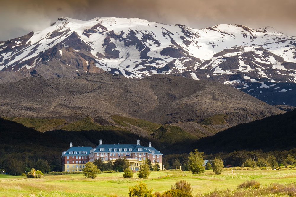
Whakapapa Village
10 min drive
The main gateway to Tongariro National Park, so it works well as a base before or after your crossing. It also puts you close to the visitor centre and several short walks.
Nineteen kilometres of volcanic ridge separate Mangatepopo Road from Ketetahi Road, and closing that gap fills most of a day. This how long to walk Tongariro Alpine Crossing guide sets out the realistic hours on track, the terrain that stretches them, and the checks that keep a plan honest. It frames the answer; the itinerary and timing sections break it down leg by leg.
Quick answer
Most walkers take seven to nine hours to complete the 19.4 km Tongariro Alpine Crossing, a one-way traverse with roughly 765 metres of climbing. Fit, unhurried parties finish nearer six hours; groups stopping for photographs, or slowed by wind, ice or congestion on the Devil's Staircase, can need ten. There is no track entry fee and no gate closing behind you.
Tongariro became New Zealand's first national park in 1887, after Te Heuheu Tūkino IV of Ngāti Tūwharetoa placed the peaks under Crown protection, and it now holds dual UNESCO World Heritage status for both its volcanic landscape and its cultural value. That history shapes the walk. The route is a one-way traverse between two roadends, Mangatepopo and Ketetahi, and it never returns to its start. Anyone working out how long to walk Tongariro Alpine Crossing is therefore planning a point-to-point day of 19.4 kilometres, not a loop that can be cut short at will. The elevation profile explains why published figures vary so widely. The track leaves Mangatepopo gently, passing the side trail to Soda Springs, before the scoria climb known as the Devil's Staircase lifts walkers onto South Crater. A flat crater floor follows, then a steep ridge to Red Crater at 1,886 metres, the high point of the day. The descent from there is loose ash into the Emerald Lakes basin, past Blue Lake, and finally a long series of switchbacks below the Ketetahi shelter into beech forest. Total ascent is close to 765 metres. Most published estimates of Tongariro Alpine Crossing walking time assume continuous movement in fair weather, which is rarely how a day unfolds. Wind on the exposed ridge, congestion on narrow sections in peak months, sulphurous steam, photographs at the lakes and tired knees on the final descent all add minutes that compound. Winter and shoulder-season conditions change the arithmetic again. The practical consequence is that time on track should be treated as a range rather than a number. Department of Conservation signage, transport operators and mountain forecasts all assume a party moving steadily; a group of mixed pace moves at the speed of its slowest member, and the alpine section offers no easy exit once committed. The track has no gate and no closing time, so the limiting factors are daylight, weather and the transport arranged at either end. Planners generally fix a target finish, subtract their expected Tongariro Crossing hike duration, add a buffer of at least an hour, and work backwards to a departure time. Read this how long to walk Tongariro Alpine Crossing guide alongside the itinerary and best-time sections, then settle transport before anything else. On a point-to-point alpine route, the shape of the day follows the shuttle, not the other way round.
“Distance is the easy part of the arithmetic; the descent, the wind and the waiting are what actually fill the day.”
This plan suits a reasonably fit walker tackling the 19.4 km Tongariro Alpine Crossing in summer conditions, allowing 7–8 hours from Mangatepopo to Ketetahi. Slower walkers, photographers and anyone adding the Ngauruhoe or Tongariro summit side trips should budget closer to 9 hours.
The best arrival window is 06:00–08:00 for better light and cooler conditions; allow 10–15 minutes at the Mangatepopo trailhead for the toilet queue and boot checks before you move.
A gentle 1–1.5 hour valley walk on boardwalk and gravel, roughly 6 km. Settle into a steady rhythm here rather than rushing, since the climbing starts immediately after.
The steepest sustained section, about 45–60 minutes of stair climbing to South Crater. Most people lose time here, so plan short standing rests instead of long sit-downs.
Around 1.5 hours to cross the flat South Crater and grind up to Red Crater at 1,886 m, the high point. Wind is strongest along this ridge, so eat and layer up before you commit to the climb.
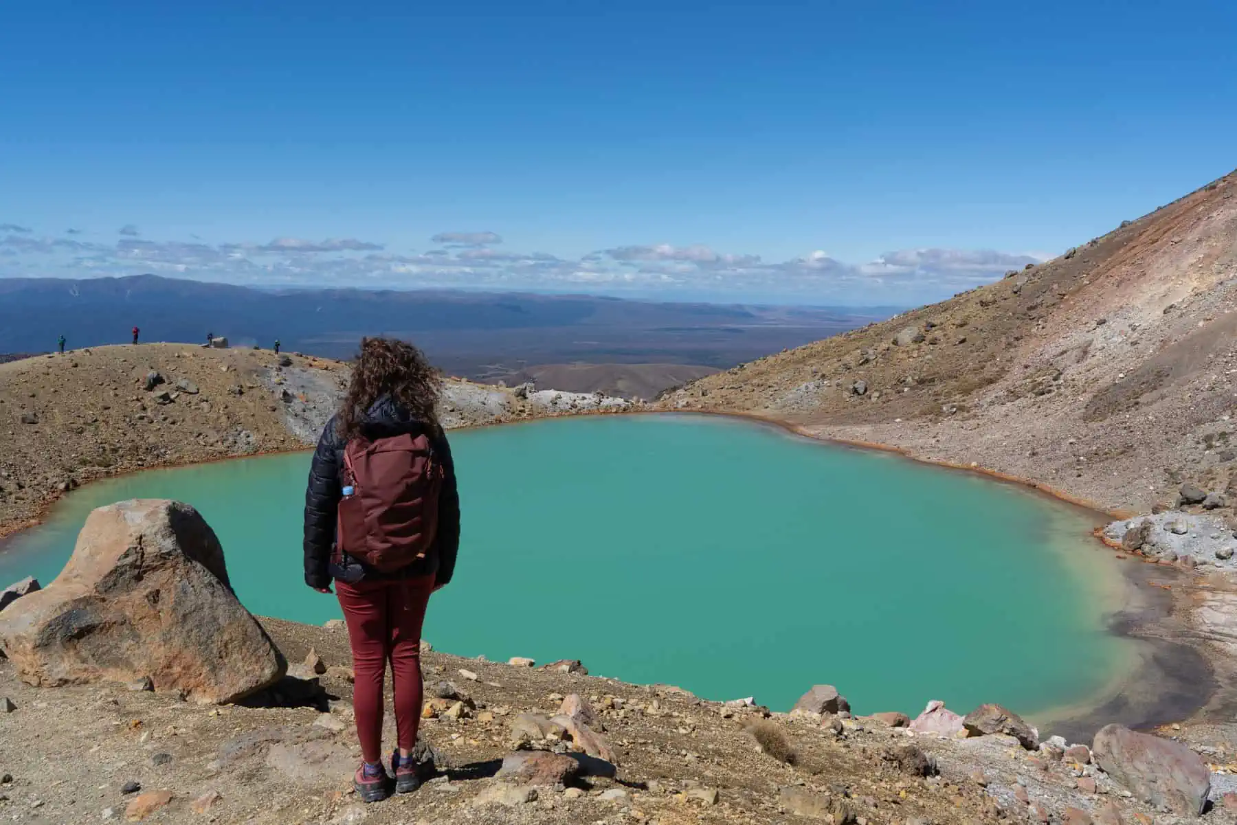
A loose scree descent of 15–20 minutes, then 20–30 minutes for lunch near the Emerald Lakes. This is the natural turnaround point for judging your pace against your shuttle time.
About 1.5 hours of easy traversing and switchbacks down the northern slopes. Time checks matter more than views now, as the last stretch is longer than it looks.
The last 2–2.5 hours drop steadily through tussock and then beech forest. Tired knees slow this section, so keep 30 minutes of buffer before your pickup.
Most walkers reach the Ketetahi end between 14:00 and 16:00 after a 06:00–08:00 start. Note your actual finish time when you book onward travel, as return shuttles run to fixed departures.
The best time to start is 06:00–08:00, which matches the official best arrival window and gives you the coolest, clearest part of the day for a long alpine walk. Early starts also help you avoid the busier mid-morning period and leave more daylight margin if conditions slow you down.
Cooler early, often 5°C-15°C
Start at opening or just before. You get better light, less heat stress, and more time to finish before the afternoon build-up.
Mild, often 2°C-12°C
A strong shoulder season for steady pacing. Early departures still matter because weather can turn quickly and daylight shortens later in the season.
Sub-zero possible; icy, snowy, windy
Winter can take longer and needs extra preparation. DOC says to allow 9 hours and leave early enough to finish before dark.
—
If you can choose the day, a weekday morning is the smoothest option. It keeps you ahead of the peak flow and gives you the best chance of a calm start.
Verdict: Best overall: Tuesday to Thursday, between 06:00 and 08:00, with April or October as the most practical shoulder-season months.
Tongariro Alpine Crossing sits in Tongariro National Park, Central North Island, New Zealand, with the track starting at the Mangatepōpō Road end and finishing at Ketetahi. The easiest approach is to use a shuttle, since the route is one-way and the finish is remote.
Shuttle from Whakapapa Village to Mangatepōpō Road end, then pick-up at Ketetahi
Shuttle from Taupō Customer and Visitor Information Centre to Mangatepōpō Road end, then Ketetahi pick-up
Shuttle from Tūrangi Customer and Visitor Information Centre to Mangatepōpō Road end, then Ketetahi pick-up
Drive to the trailhead only if you have a confirmed plan for the finish at Ketetahi; self-shuttling is not the simple option here
Arrive at the Mangatepōpō start, not the Ketetahi finish, because the Crossing is walked one way from Mangatepōpō to Ketetahi. The remote trailhead and limited parking make an early shuttle the smoothest choice, and DOC notes the best arrival window is 06:00–08:00.
Preparation for the Tongariro Alpine Crossing matters more than pace, so sort these items before you set out.
The Tongariro Alpine Crossing runs through land of deep significance to Ngāti Tūwharetoa, and the volcanic terrain is fragile underfoot. How you behave on the track matters as much as how fast you walk it.
If you have another night in the park, the easiest add-ons are short walks around Whakapapa Village or a nearby scenic stop on the western side of Tongariro National Park. These pair well because they keep your second day light after a long alpine walk.
10 min drive
The main gateway to Tongariro National Park, so it works well as a base before or after your crossing. It also puts you close to the visitor centre and several short walks.
10 min drive
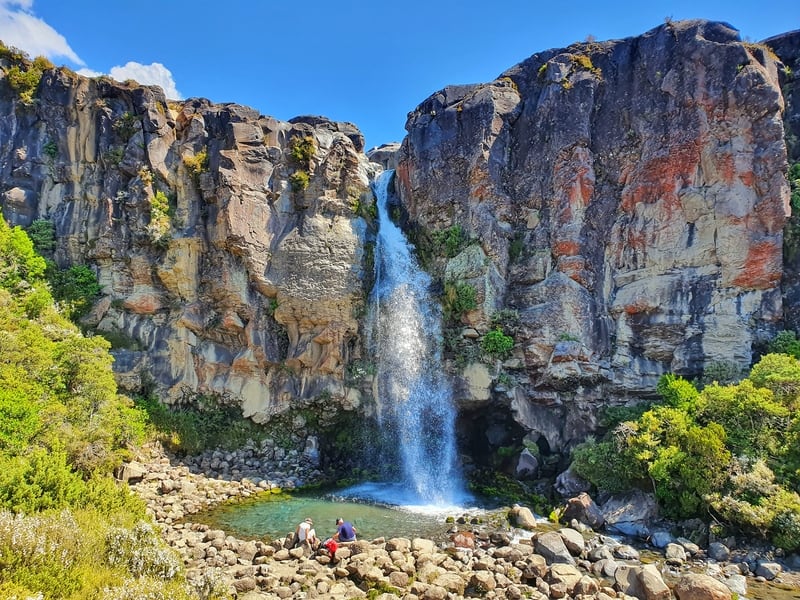
A compact loop from Whakapapa Village with mountain views and a 20 m waterfall. It is a practical choice if you want a shorter walk after the Crossing or as a bad-weather backup.
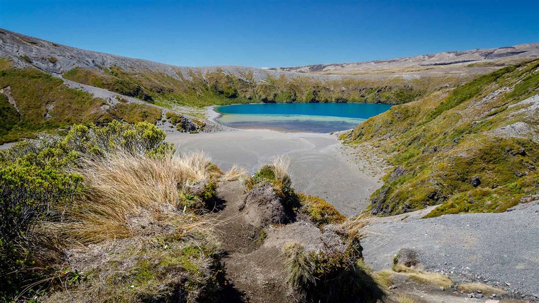
10 min drive
This longer half-day option starts from the same Whakapapa area and gives alpine views without the full Crossing commitment. It suits a second-day plan when you still want a high-country walk.
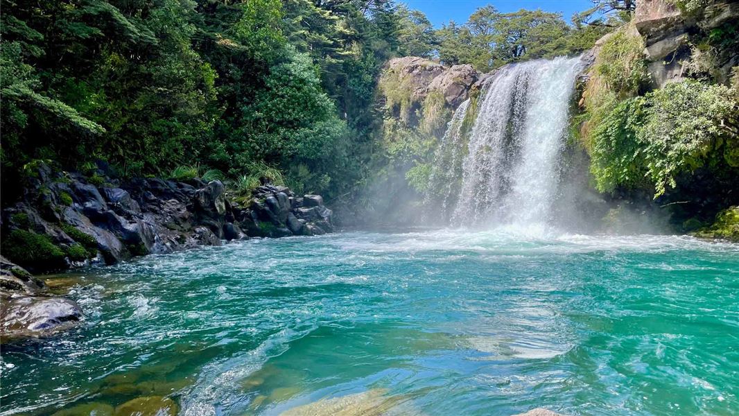
15 min drive
A short stop near Whakapapa that adds a waterfall viewpoint without much extra time on the road. It works well if you are heading through the park and want one easy scenic leg.
Everything you need to know about how long to walk tongariro alpine crossing
Most visitors plan a long alpine day rather than a short hike. DOC describes it as a challenging trip with about 17 kilometres of track, +/− 1196 metres of elevation change, and a route from Mangatepōpō to Ketetahi; many walkers take 6 to 8 hours, but you should allow more if you stop often or are less experienced.
The shuttle changes the logistics, not the walking time. You still need to allow a full day for the crossing itself, and DOC says the best way to reach the trail is by shuttle because summer parking at Mangatepōpō is not available for track users.
Bookings are recommended for anyone using any part of the Tongariro Alpine Crossing track. DOC also says a track booking is needed to use a shuttle or guided walk service, and there is no cost to book.
There is no track entry fee for the Tongariro Alpine Crossing. DOC states the entrance fee is 0 NZD, while shuttle transport is separate and is arranged through local visitor centres and operators.
DOC does not recommend the track for children under 10. The route is exposed, uneven, and alpine, with volatile weather and steep sections, so families should judge fitness, conditions, and experience carefully.
Start early and aim to be on the trail in the cooler morning window. DOC lists the best arrival window as 06:00–08:00, which helps with light, temperature, and a smoother start to a long day out.
A common mistake is underestimating the mountain conditions. Walkers often focus on distance alone and miss the real demands of wind, cold, volcanic terrain, loose scree, and the long descent from the high point past the Emerald Lakes and Blue Lake.
Do not expect to park at the Mangatepōpō car park in summer. DOC says there is no parking there for visitors doing the crossing, and the preferred access is by shuttle rather than roadside parking.
Shuttle from Turangi
Read more Tickets & toursShuttle from National Park
Read more Tickets & toursKetetahi Car Park Shuttle
Read more GuideShuttle Timetable & Schedule
Read more GuideShuttle Price & Cost
Read more GuideCan You Drive to Tongariro Crossing?
Read more Tickets & toursShuttle from Taupo
Read more Tickets & toursOne Way Shuttle Transfers
Read more